
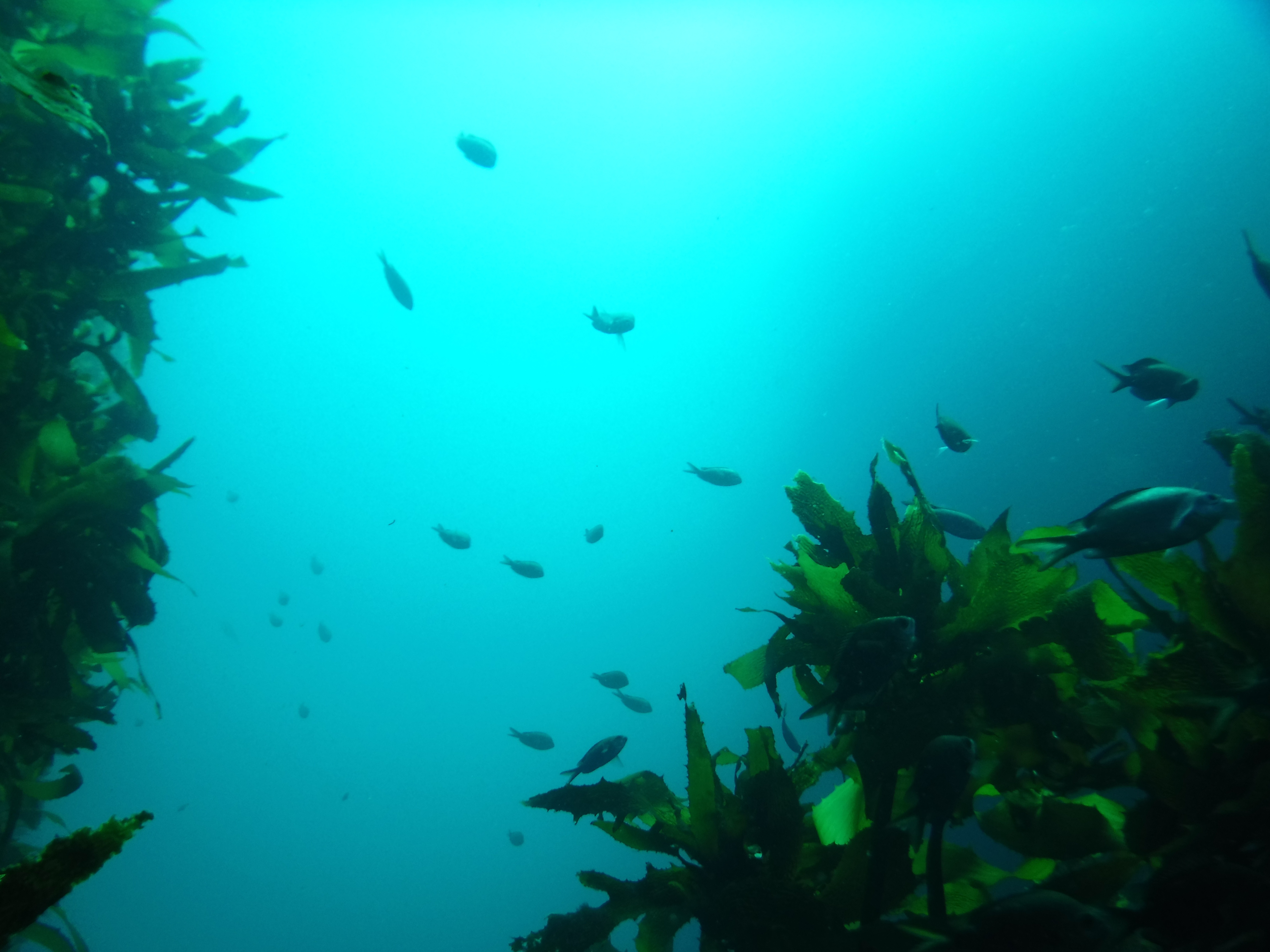
“If we can map what lies beneath, we can protect it. We can use it wisely and we can sustain its abundance for generations to come.”
Mātauranga Māori scientist Dr Oliver McLeod
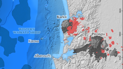
The wild west coast. Old volcanic rocks sit along the coastline at Karioi-Raglan and Ngātutura Point. Offshore, the continental shelf dips gently west before dropping sharply to a 200m depth about 50km offshore. The inner shelf was surveyed using aeromagnetics in 2010, revealing numerous, highly magnetic areas between Karioi and Kārewa Island. Kārewa, a lone volcanic island located 20km offshore from Karioi. The island features prominently in Tainui pūrākau.
When we map and seek to understand the land above water, the reasons are clear.
We find good ground for farms and towns. We mark places of beauty and sites of cultural significance. We learn where to walk, where to build, and where to tread lightly.
Reasons to explore beneath the ocean’s surface are less obvious. But mapping what lies beneath brings similar benefits.
It shows where fish may gather and ecosystems thrive. It points to places fit for clean energy sites and to taonga that should be left alone for their natural beauty and cultural significance.
Waikato Regional Council manages the coastal marine area of the region out to 12 nautical miles at sea. But, to care for it, we must first know it and understand it.
Much of the coastline of our region has been well studied, especially the calmer east coast. Yet, as Mātauranga Māori scientist Dr Oliver McLeod explains, gaps in our knowledge remain.
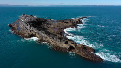
The wild west coast. Old volcanic rocks sit along the coastline at Karioi-Raglan and Ngātutura Point. Offshore, the continental shelf dips gently west before dropping sharply to a 200m depth about 50km offshore. The inner shelf was surveyed using aeromagnetics in 2010, revealing numerous, highly magnetic areas between Karioi and Kārewa Island. Kārewa, a lone volcanic island located 20km offshore from Karioi. The island features prominently in Tainui pūrākau.
“The west coast, from Port Waikato to the Taranaki Peninsula, has been little studied by modern science,” says Oliver.
Strong winds from the Tasman Sea and heavy swells make research tough. Fewer people go there to play or explore, so the underwater ecology has drawn much less attention.
It was assumed by many to be mostly sand and mud. And, based on this belief, the cost of looking more closely seemed high and funding was scarce.
Still, Oliver and his colleagues, spurred by curiosity and employing more than a little kiwi ingenuity, persevered and innovated.
Using simple, low-cost tools and shared knowledge, they made a major find – at least 70 previously unverified underwater volcanoes.
“This is a scientific verification,” Oliver says, “but the seed of knowledge it grew from was mātauranga Māori (Māori knowledge).” The work, he adds, helps affirm what tangata whenua already knew.
Oliver’s spark of inspiration came from a pūrākau (tribal narrative) told by a kaumātua (elder) from Whāingaroa (Raglan). And his experience as a geologist with intimate knowledge of the extinct volcanoes Karioi and Pirongia gave him the conviction that this was a lead worth following.
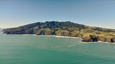
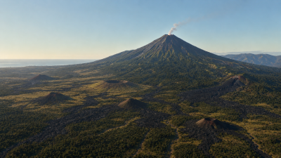
Present-day view of Mt Karioi towards Papanui Point, showing the modern coastline, steep volcanic landforms, and the Tasman Sea.
He and fellow scientists matched the story with reef locations from fishermen and magnetic maps from prospecting for ironsand (sand rich in iron minerals, primarily magnetite, often used for industrial applications) undertaken in the 2010s. In the process, they were able to expand the map of the western North Island's volcanic fields by 25 per cent, at almost no cost.
The decade-old prospecting surveys measured seafloor magnetism to find the ironsand. By law, commercial surveys like this eventually enter the public domain after five years (to be used freely by anyone).
Like ironsand, volcanoes are also magnetic, rich in iron from lava and ash. So, the mineral prospecting had provided unforeseen scientific insights and public policy opportunities.
AI-assisted reconstruction of the Karioi–Papanui Point landscape approximately 2.5 million years ago, when lower sea levels exposed a broad coastal plain covered in vegetation and dotted with volcanic cones similar to those found in the Auckland region today.
In the pūrākau, Oliver recounts, Pirongia and Karioi were sisters living inland with Kārewa. Kārewa, also named Gannet Island by Captain Cook, was Karioi’s husband and once lived in-land with her. But, after an affair with her sister, Pirongia, Kārewa was cast out to sea. The tamariki (children), the story says, were scattered between them.
Karioi is an extinct volcano and Kārewa a rocky-reef islet. Reference to children, Oliver knew, likely pointed to the presence of many smaller volcanoes around Karioi and beneath the water. The story preserved ancient knowledge of the seafloor.
These volcanoes lie between 10 to 50 metres down – too deep to see and beyond comfortable freedive limits. How did people know they were there?
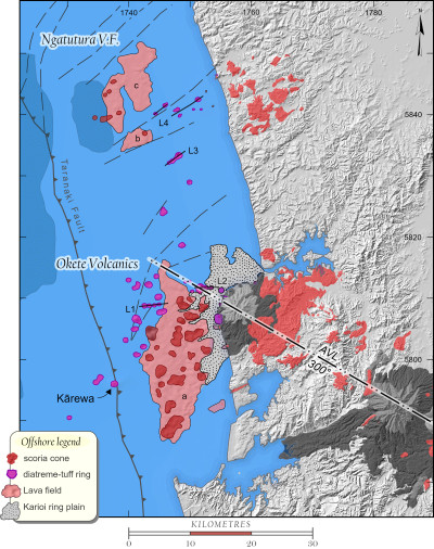
Geological interpretation of continental shelf bedrock. The red and purple areas are ancient volcanoes related to volcanic swarms near Karioi and Ngātutura Point. The Raglan coast also contains abundant volcanic rubble from the slopes of Karioi.
The answer lies in experience. Māori arrived in Aotearoa as expert seafarers and fishers, long familiar with the volcanic islands and reefs of their tūpuna (ancestors). Underwater volcanoes form rocky reefs – rich nurseries for marine life.
These reefs are vital to healthy fisheries, resilient ecosystems, and long-term marine sustainability – especially when they occur in clustered chains of underwater volcanoes.
By fishing those waters, generation after generation learned the pattern. Karioi and Kārewa above water and the bounty hauled up from below formed a mental map held in collective memory and preserved in compelling stories. The pūrākau guided fishers to the best grounds.
Once we understand this, it’s easy to see why this underwater landscape matters to the mana of west coast iwi and how their fishing expertise was preserved through the pūrākau.
It’s easy to see why it matters to scientists like Oliver. And it’s easy to see why places like this, the thrill of discovering them and the stories that communicate their value to others should matter to all of us.
Oliver hopes to learn more about these underwater volcanoes and says a ‘drop-camera' survey would be the logical next step – so the abundance of sea life around these features could be observed via video feed.
“Because, if we can map what lies beneath,” he says “we can protect it. We can use it wisely and we can sustain its abundance for generations to come.”