“Before 1998, there was only a single year with four days of rain in this [extreme] percentile. But between 1998 and 2025, there have been 6 years with four or more of these events.”
Waikato Regional Council Senior Water Scientist Bevan Jenkins
Flood waters engulf low-lying areas around Te Aroha town
With all the heavy rain we’ve experienced in the Waikato region, many people are wondering whether extreme weather has become more frequent and intense.
New analysis of rainfall data by Waikato Regional Council Senior Water Scientist Bevan Jenkins shows extreme rainfall events in some parts of the region have.
“Rainfall has been measured at the Ruakura rainfall station since 1907,” says Bevan, “providing one of the longest records of daily rainfall totals in the region.”
“It supports what a lot of people have been thinking, experiencing and asking us about. Extreme rainfall events (defined as the 0.5 per cent right at the top end of the scale) are getting more frequent at this site.”
“The data shows a clear and notable step up in the annual frequency of extreme daily rainfall events since the early 2000’s. Before 1998, there was only a single year with four days of rain in this percentile. But between 1998 and 2025, there have been 6 years with four or more of these events.”
 Count of rainfall events per year greater than 99.5th percentile of daily rainfall (42.3mm) at Ruakura station
A similar picture emerges at the Matawai Stream rain gauge established in 1990 in the Coromandel. There were no rainfall events in the most severe 0.5 per cent prior to 2000 at the site, but 12 after.
However, other rain gauges show more continuity than change, indicating potential changes in the frequency of extreme weather aren’t happening in a uniform way for all parts of the region.
“This initial analysis only includes a small percentage of the data we have access to, so there remains more work to be done to provide a more complete picture.”
“But what we are starting to see does appear to match what we know about climate change and its impacts.” says Bevan. “We know temperatures are rising, with NIWA data showing eight of the 10 warmest years on record in New Zealand have been recorded since 2009."
 A climate stripe graph showing annual and decadal average temperature in degrees Celsius between 1910 and 2019. Note: Stripes on the top row show the annual average temperature for a year. Stripes on the bottom row show the average temperature by decade.
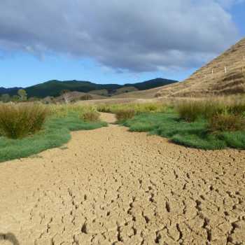
Data points to the increasing frequency of droughts as well as extreme rainfall
Warmer temperatures allow the atmosphere to hold more humidity before it reaches the saturation point, where water is discharged as rain. The increase in the saturation point is exponential, meaning even a small rise in average temperatures can result in big increases in the amount of water that can be held – and the corresponding the severity of rainfall events. At its extremes, this can support atmospheric rivers, which have been responsible for some the country’s worst flooding events, including the Auckland Anniversary flooding.
“And it’s not just heavy rainfall.” says Bevan. “A wide range of data also points to the increasing frequency and severity of severe storms and droughts, with a 2024 University of Waikato–NIWA study concluding New Zealand can expect to see more extreme dry spells punctuated by increasingly supercharged rainfall events.”
Bevan’s research highlights the importance of long-term monitoring to help inform the council’s approach to regional resilience.
“Regional resilience is one of Waikato Regional Council’s top strategic priorities” says Principal Regional Resilience Advisor Rick Liefting.
“The increasing scale and frequency of these extreme weather events in parts of our region means the status quo for managing flood risk needs to adapt to find innovative new solutions that anticipate the challenges and mitigate the risks to communities.”
“One of the ways we can do that is by exploring nature-based solutions which can be great for absorbing or safely diverting heavy rain, rather than trying to hold it back with more traditional stopbanks.”
“Another is hydrological modelling, which allows us to anticipate where heavy rainfall might go during an extreme weather event. This enables us to be better prepared in our management and maintenance of built infrastructure – and support our communities when severe weather hits.”