"We’re very pleased to be able to enhance this resource … We love hearing how people have used it to inform discussions and spark further work projects."
- Rick Liefting, Team Leader – Regional Resilience
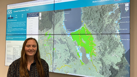
Regional Resilience Specialist Celeste Davies-Calway with the latest version of the coastal inundation tool on big screens
Our Regional Resilience team has bolstered the dataset that drives the Waikato Coastal Inundation Tool and enhanced its user interface. You can still simulate the effects of various sea-level scenarios, but now for the whole region and with better functionality.
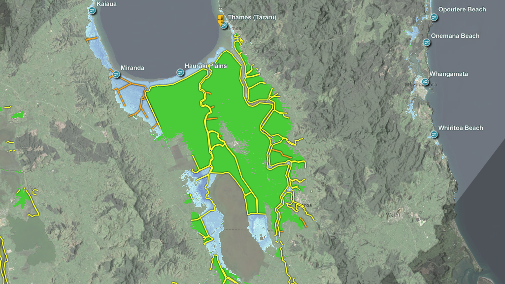
Severe weather events along coasts, estuaries and adjoining river mouths are the main triggers of coastal inundation (flooding). The tool illustrates how tides, storms and projected sea-level rise could impact coastal areas on a regional scale. This highlights areas with higher risk, where further work and planning is needed to enhance resilience.
While earlier versions of the tool covered most of our coastal regions, we were missing data for some areas. The new tool covers the entire region including inland areas of the lower Waikato River (north from Huntly) and all of the west coast.
The team worked with Bay of Plenty Regional Council, who were responsible for the background architecture and the look and feel of the tool. The updated version simplifies changing scenarios and allows you to access the tool on your smartphone.
Waikato Regional Council’s Senior Spatial Scientist Dan Borman created the layers that render the data into an easy-to-visualise map format for both regions.
Rick Liefting leads our Regional Resilience team and says the tool is proving its worth, logging over 12,500 visits since January 2024 and now offering better insight: “We’re very pleased to be able to enhance this resource, which has been available since 2016. We love hearing how people have used it to inform discussions and spark further work projects.”
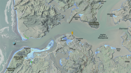
Raglan showing a sea level of 3.8 metres which represents the upper storm tide range with 1.0 metres of projected sea-level rise
He says no one should worry that it affects their house value or insurance; it supports higher level planning rather than individual property decisions. So far, the tool has supported the Wharekawa Coast 2120 Plan, The Thames-Coromandel District Council shoreline planning process, Waitomo District Council and Waikato District Council proposed district plan and the Hauraki Plains Adaptation Plan. (See the links below for more information about these.)
Regional Resilience Specialist Celeste Davies-Calway says information is key and the tool reveals some interesting attributes of the region, including how low some areas are even tens of kilometres from the coast: “The Hauraki Plains area south of the Firth of Thames is very low-lying. Projected future sea levels could impact areas people may not have considered as having ‘coastal impacts’.”
The team hopes that the updated tool and data will assist seasoned users and will encourage more people to take a look either for genuine planning reasons or just out of sheer interest in the areas where they live, work or play.
Everyone can access the Waikato Coastal Inundation Tool for free.