Waikato Regional Council’s most significant assets are the various infrastructure that make up this region’s flood protection schemes.
These include, at last count, 116 pump stations, 448 floodgates and 622 kilometres of stopbanks.
For the assets that are under water, it’s a big job to regularly monitor and structurally audit them. And an even bigger job to complete an asset overhaul, if and when required.
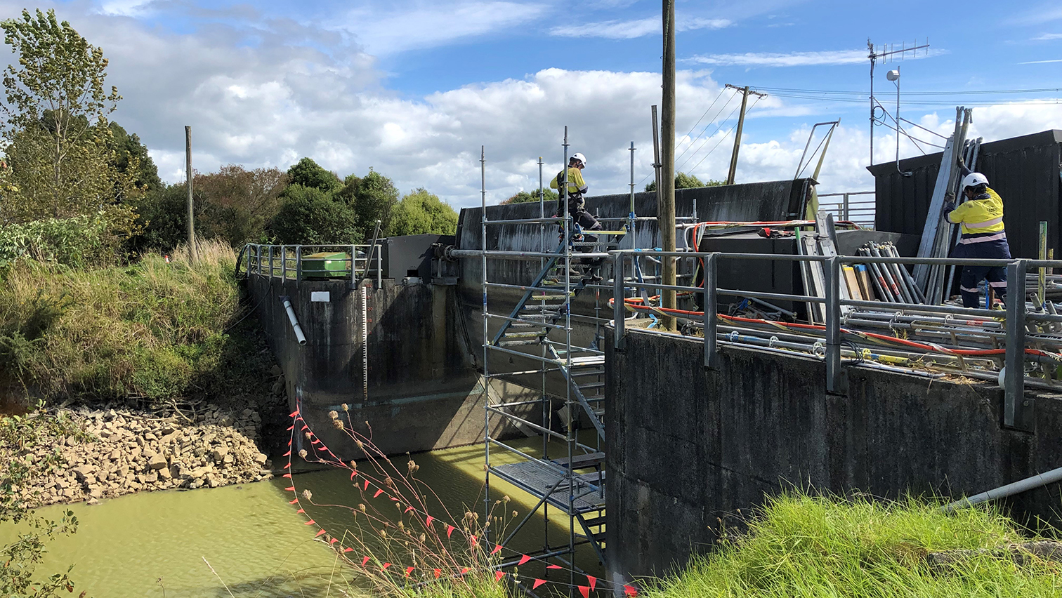
For the repair of the Lake Waikare control gate, completed in May this year, it was a really, really, really big job!
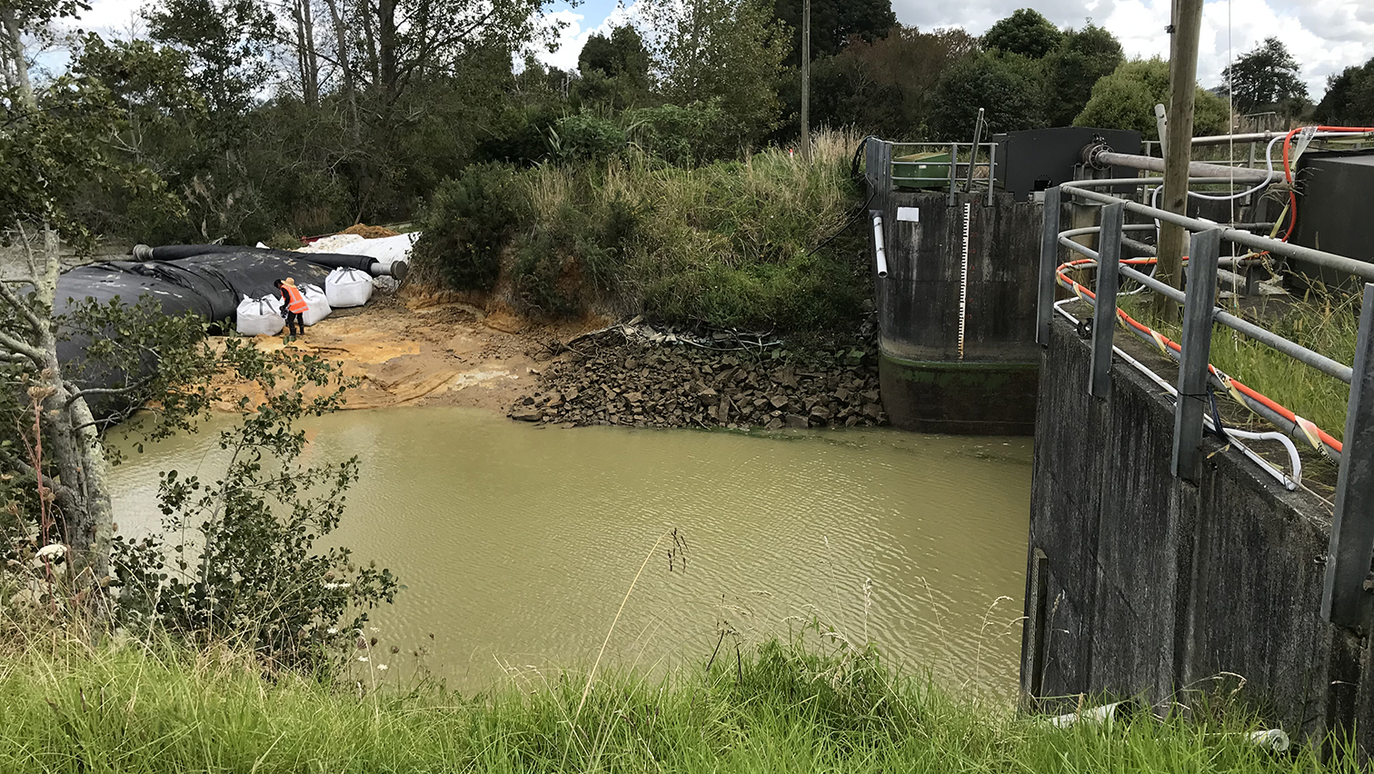
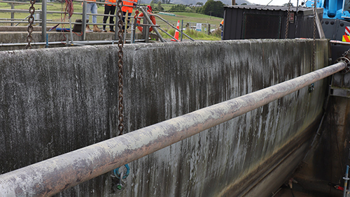
The Lake Waikare control gate is a critical asset within the Lower Waikato flood control scheme, as it controls the lake level to ensure adequate flood storage within the lake for a 100-year flood event in the Waikato River.
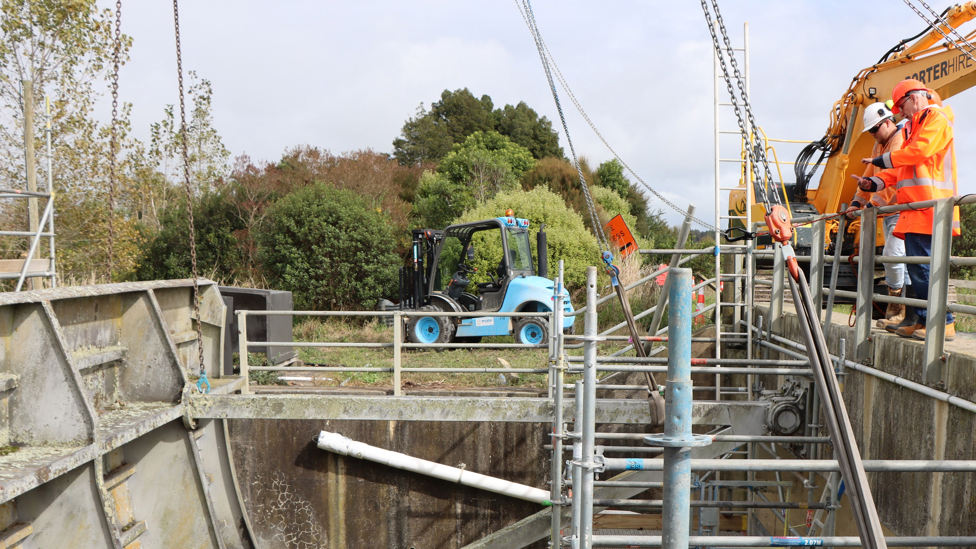
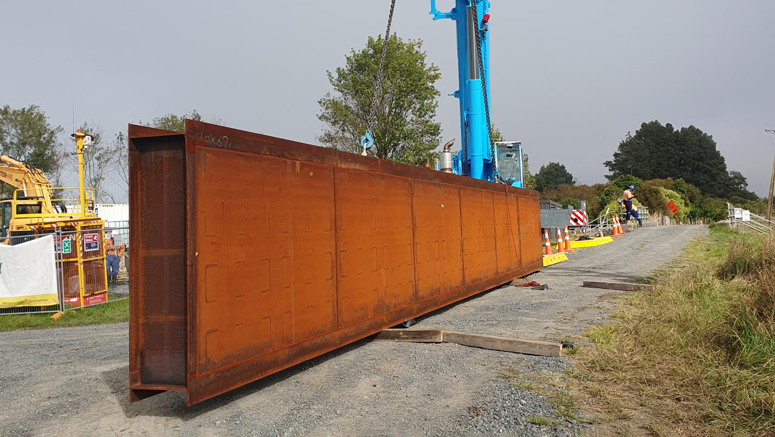
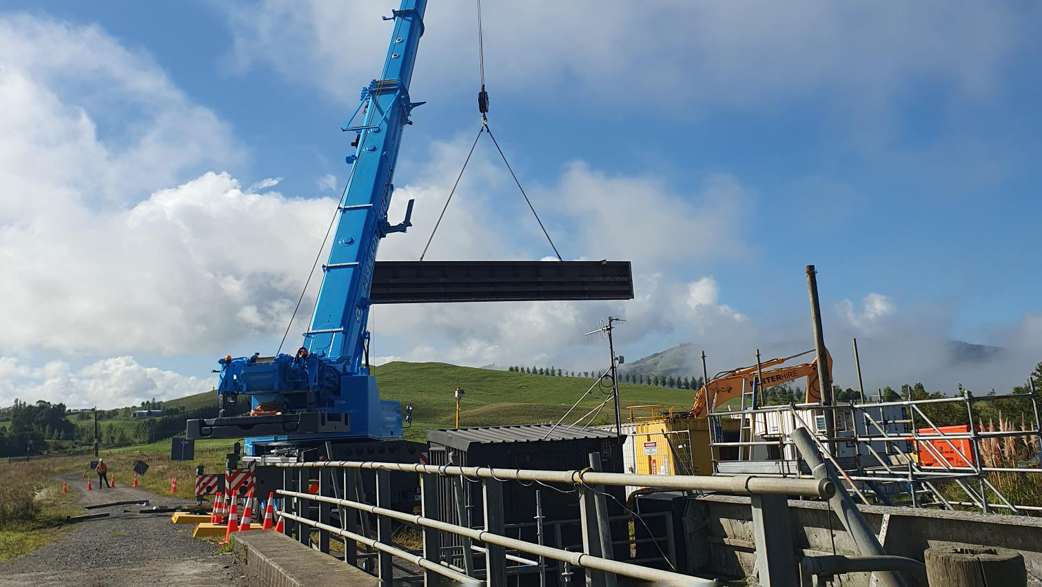
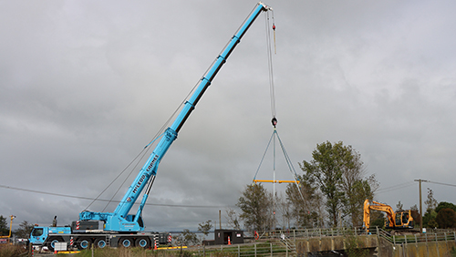
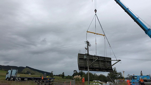
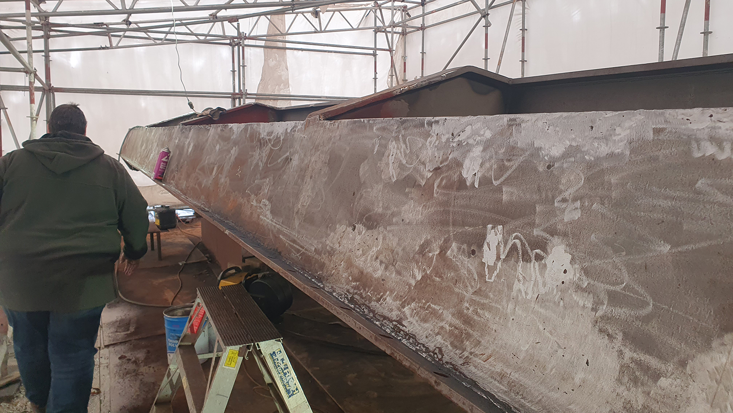
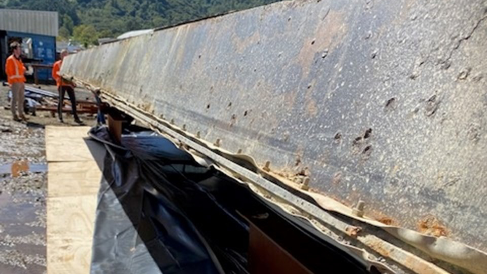
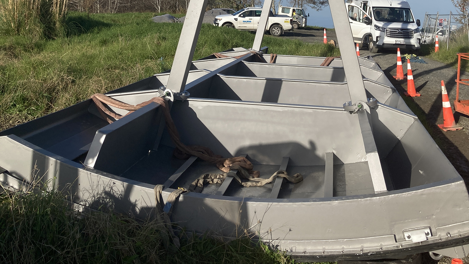
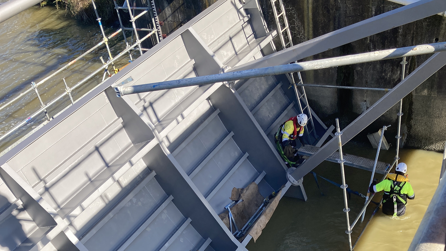
The control gate was installed in 1965 and had a leaking seal that needed to be fixed. The 14-tonne gate is made of steel and measures 12 metres in length by 4 metres in height.
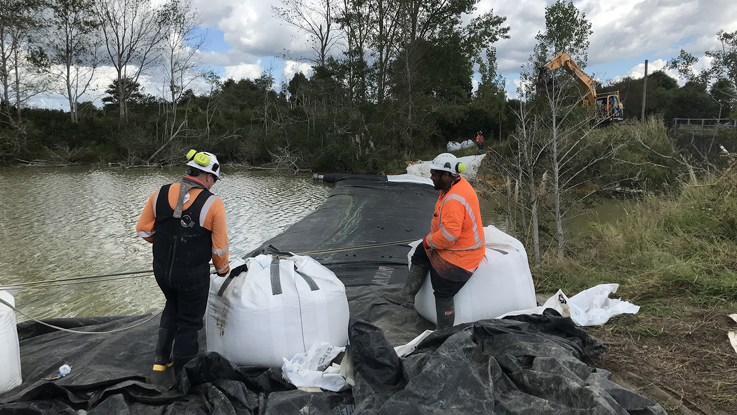
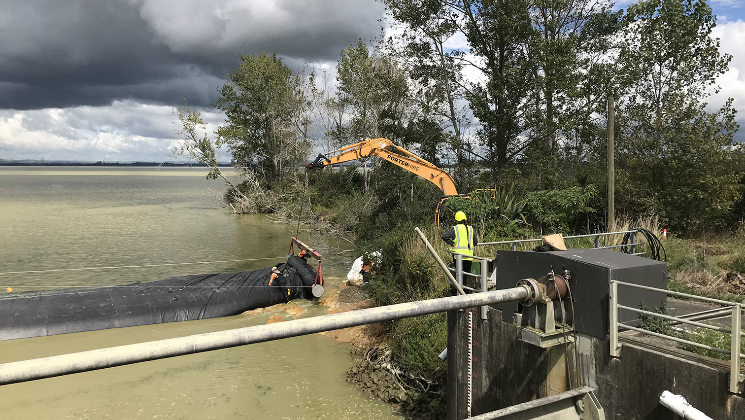
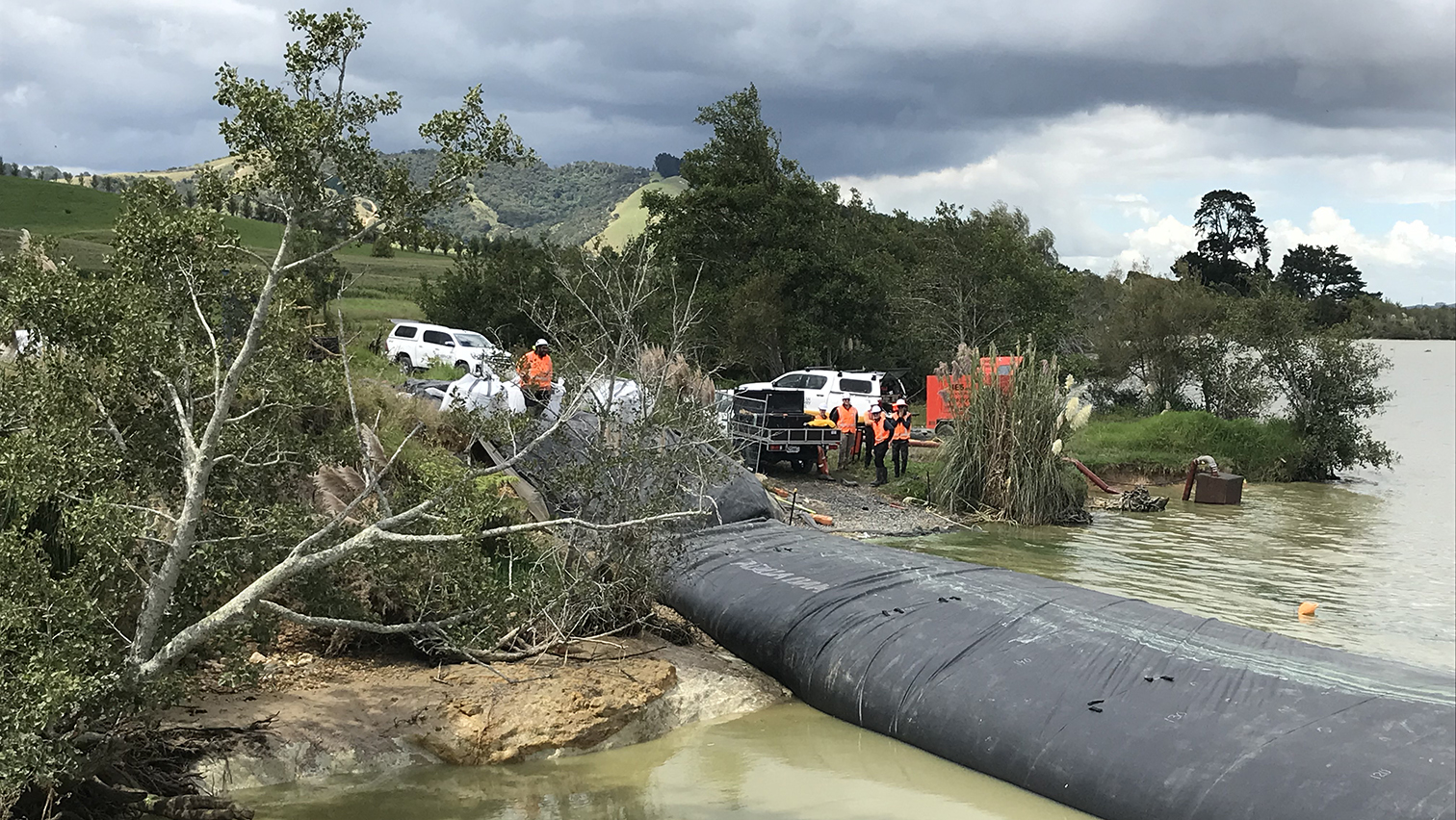
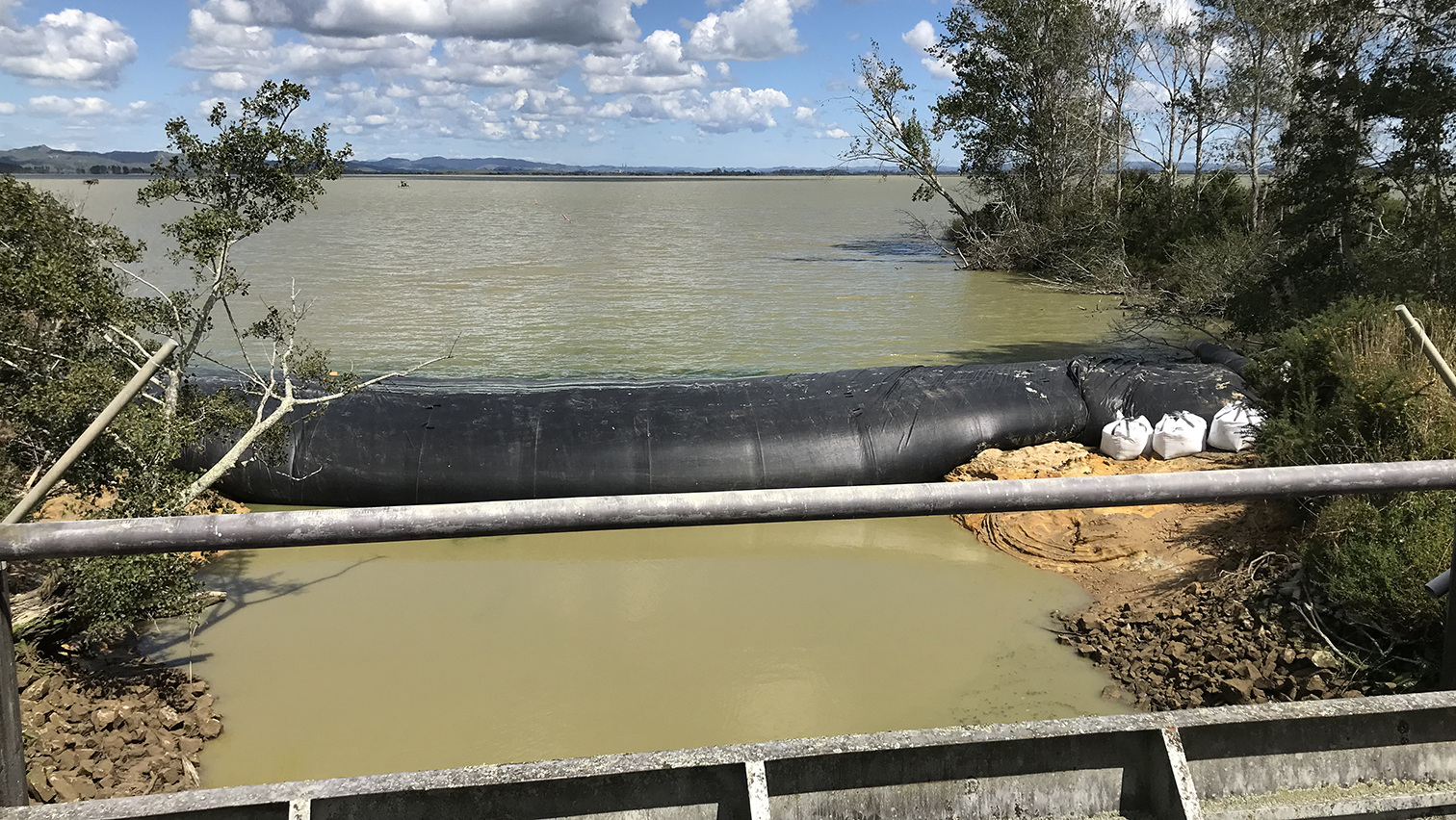
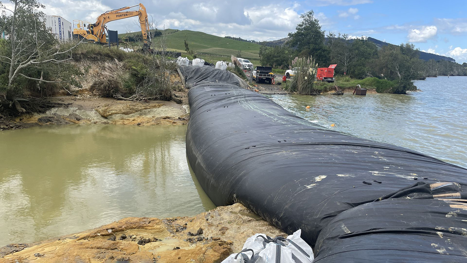
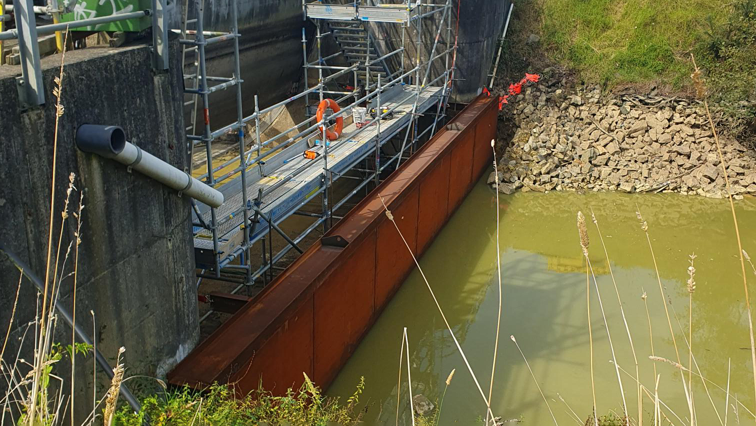
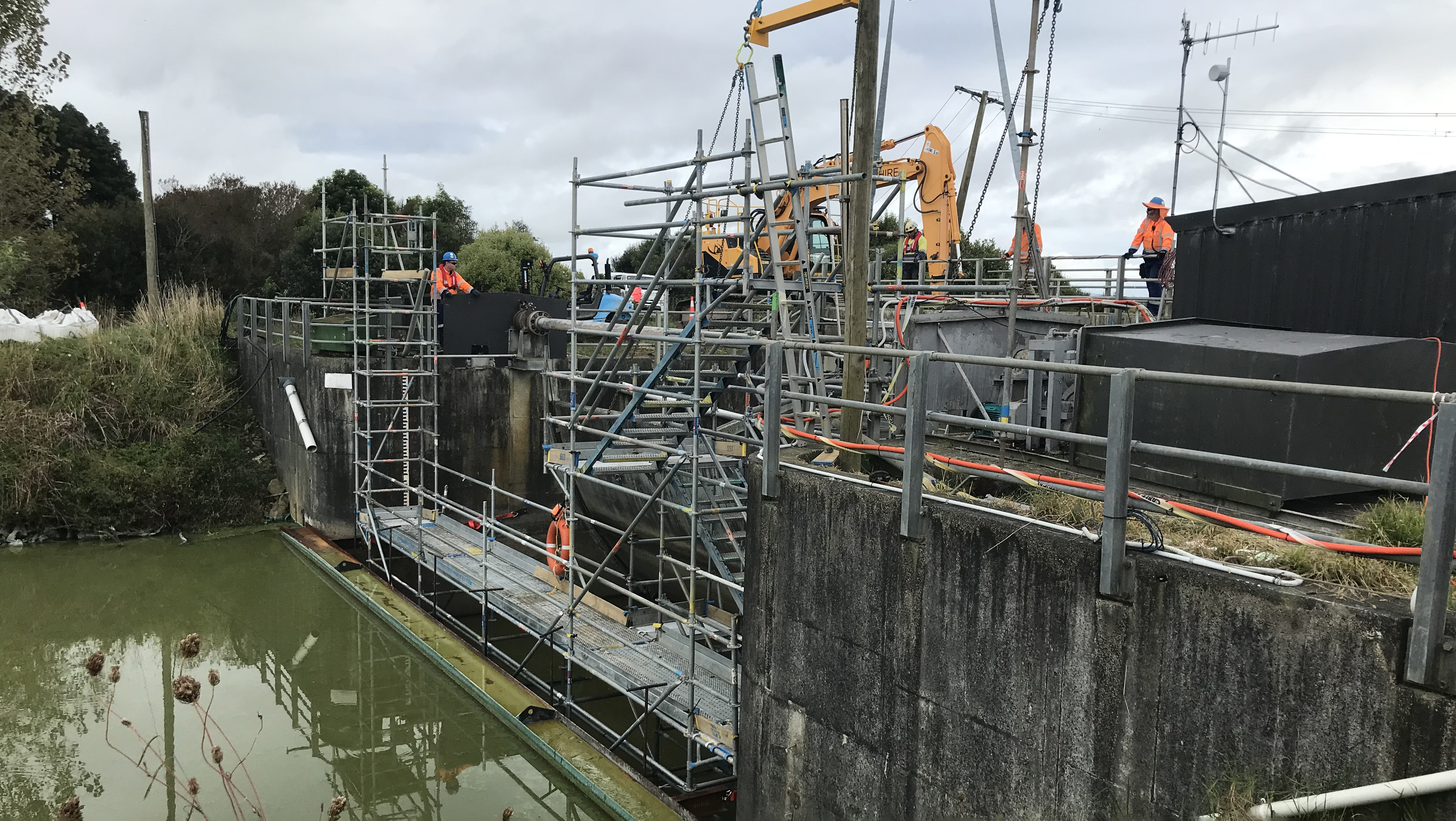
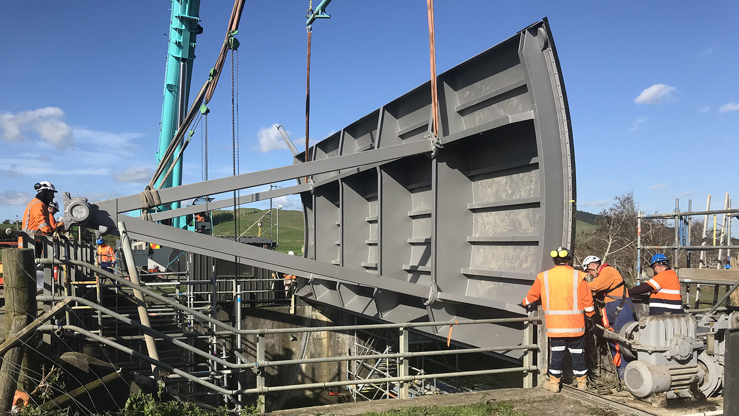
Obviously, we can’t just remove the gate and discharge some 45 million cubic metres of water from the second largest lake in the Waikato into the receiving Whangamarino Wetland.
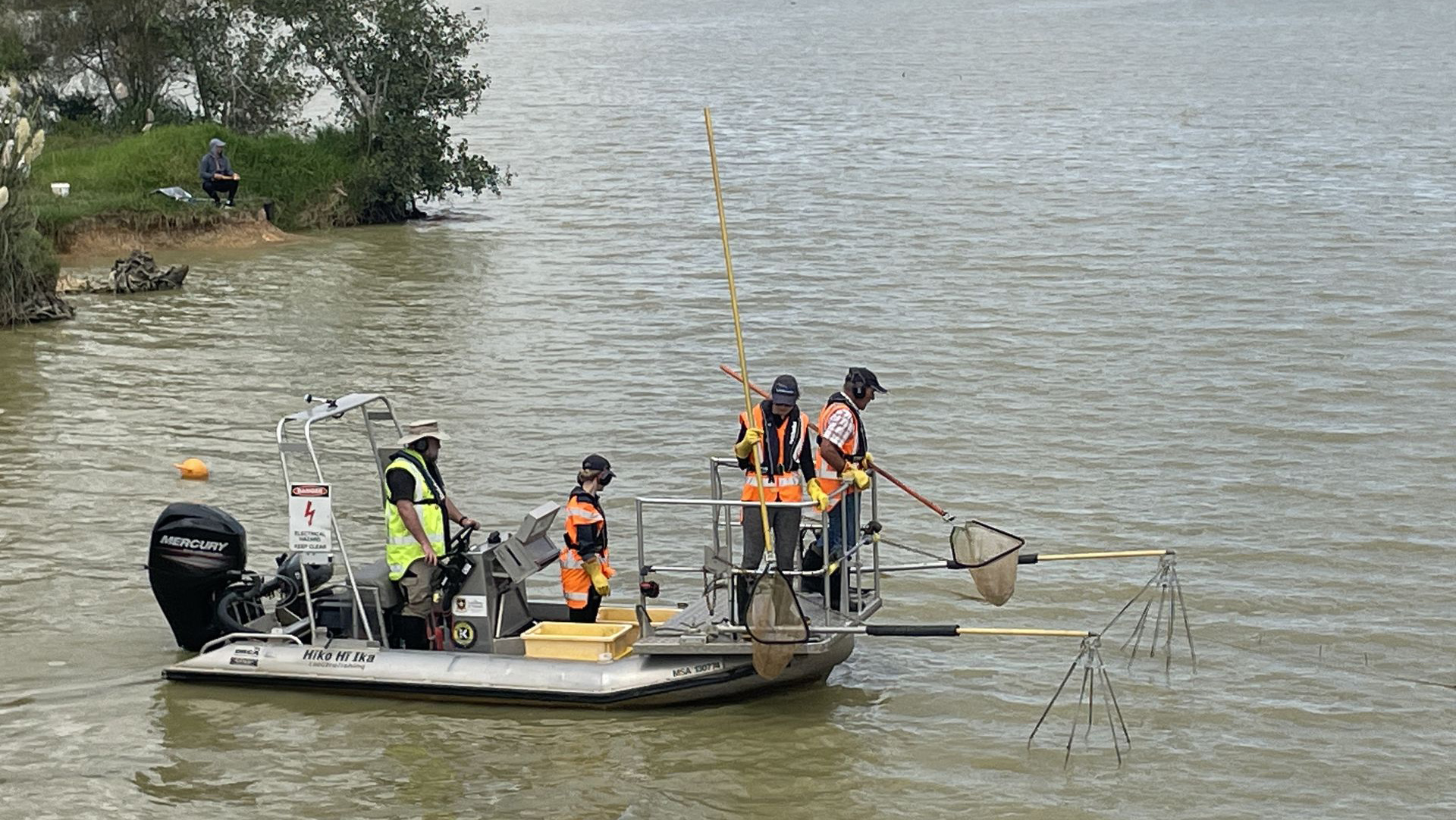
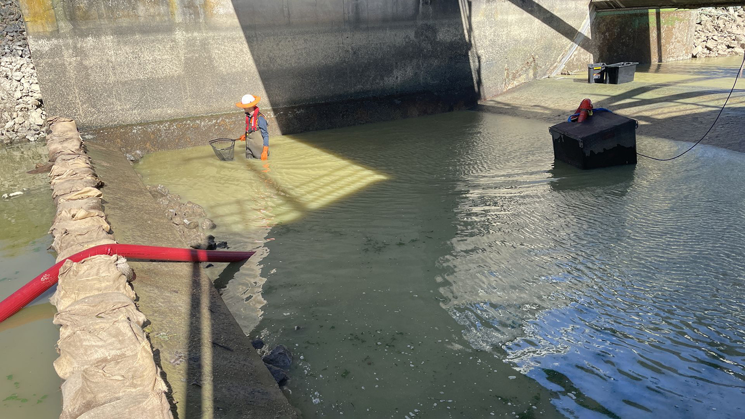
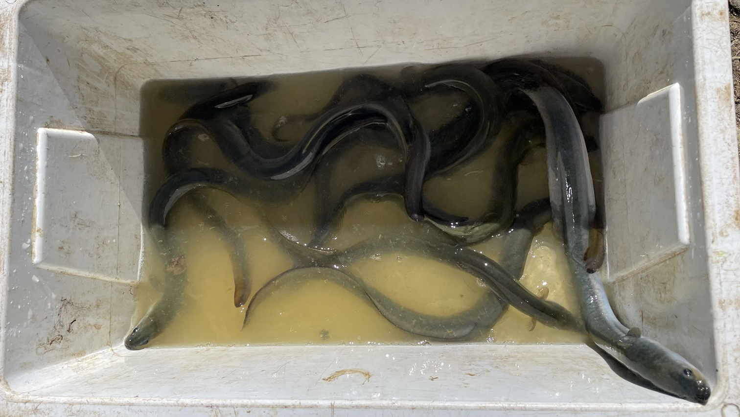
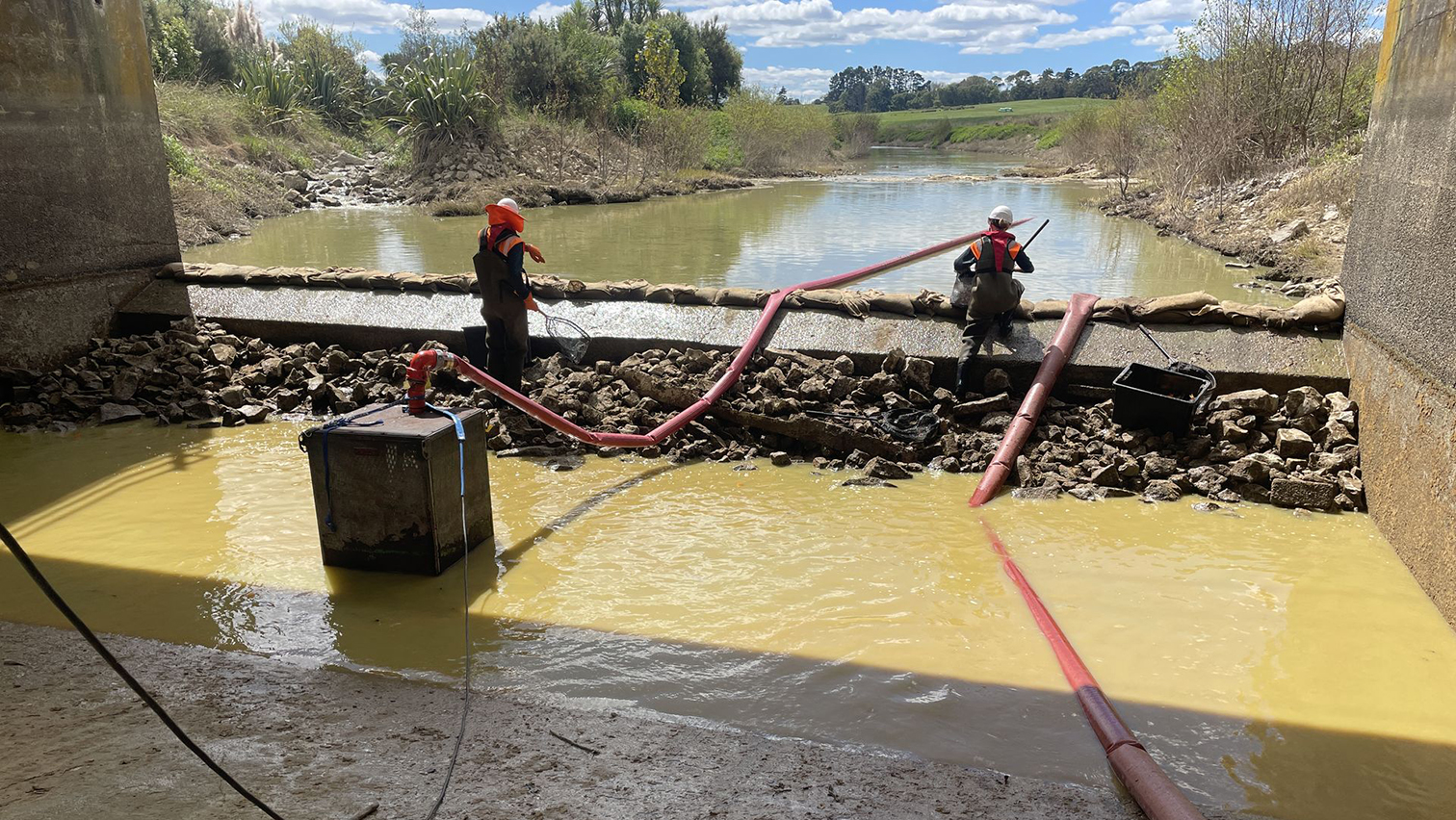
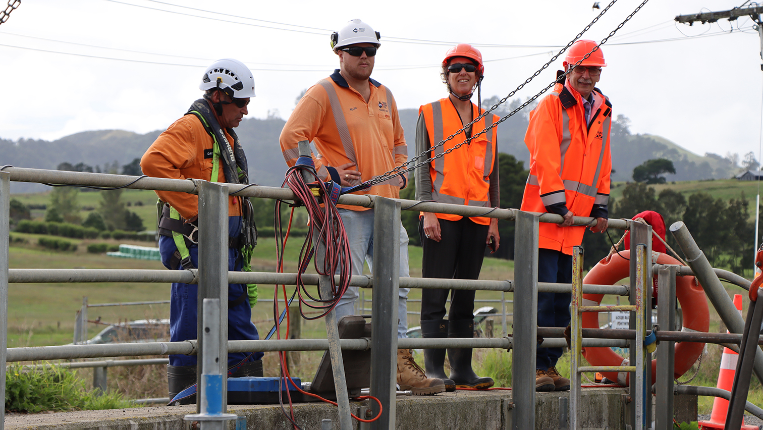
We had to hold back the water back, dewater the working area around the gate, and also relocate fish back into Lake Waikare (except for the pest fish – they were humanely euthanised).
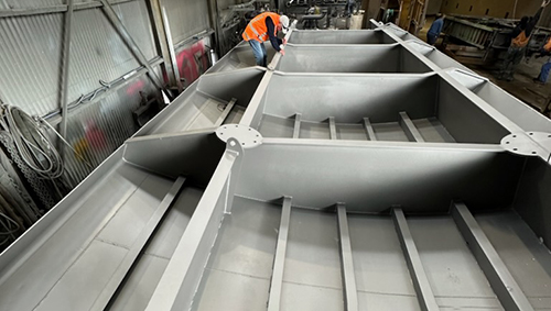
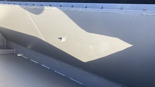
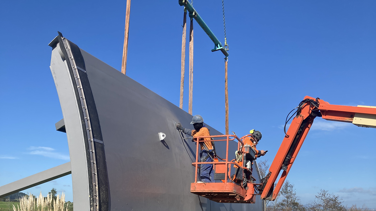
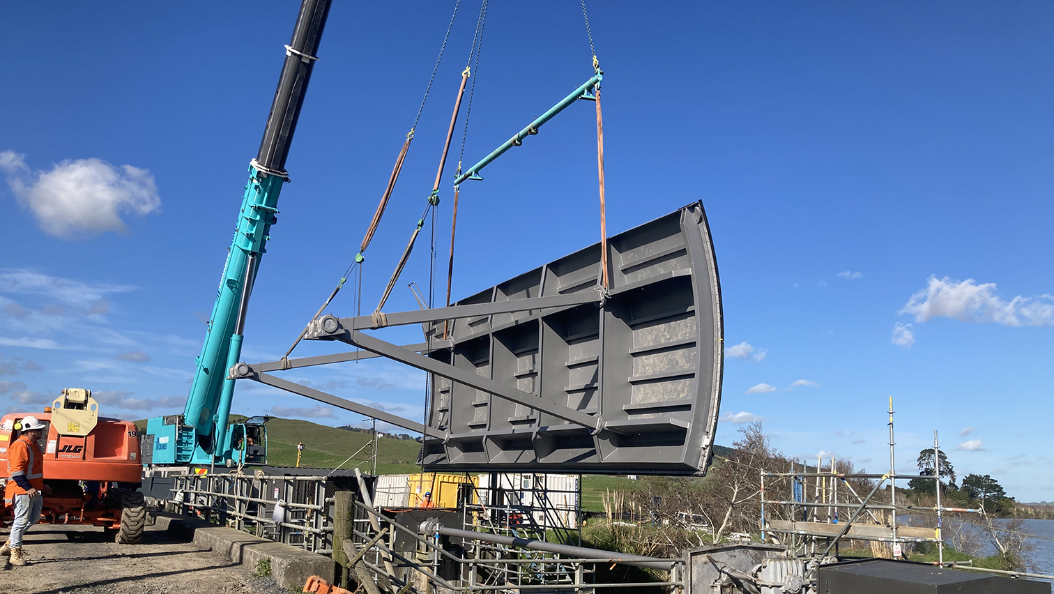
Then we could remove the control gate and send it and various components off for their overhaul.
Check out the photos to see how we did it.

More about the Lake Waikare control gate
The radial control gate at Lake Waikare was installed in 1965 at the northern foreshore as part of the Lower Waikato and Waipa Flood Control Scheme. The gate is operated in accordance with resource consents to maintain a range of seasonal lake levels. The lake is used as a flood storage area to ensure reduced flood levels downstream, with the floodgate controlling the amount of water within the lake.
Previously, the lake water levels fluctuated with the rise and fall in the Waikato River. Flooding of farmland and towns along the Lower Waikato River and associated tributaries, at times, would damage and devastate communities. In 1953 and 1956, two large floods caused the closure of state highways, lifelines and railway at several locations for more than two months. More than 45,000 hectares of land was affected by flooding and the damage caused was so large that flood protection was considered a matter of national importance. The Waikato Valley Authority was established by Act of Parliament in 1956 to lead and oversee the design and implementation of the Lower Waikato Waipa Flood Control Scheme. In 1958, another flood larger than the 53 and 56 floods occurred, which made it obviously clear that the scheme was required to ensure economic stability and development.
The scheme, completed in 1982, includes systems of stopbanks, pump stations, floodgates, control gates, spillways, channel diversions, bridges, detention dams, drains, rivers and streams work. It was 75 per cent funded by the Government through the Ministry of Works and 25 per cent beneficiary landowners.